Farming, Post
The Meteorological Command Center: A Comprehensive Guide to Weather Monitoring Tools for Farms
May
The Meteorological Command Center: A Comprehensive Guide to Weather Monitoring Tools for Farms
In the grand hierarchy of agricultural variables, weather is the “final boss.” A farmer can optimize soil nutrients, select the perfect high-yield seeds, and deploy the most advanced robotics, but a single unpredicted hailstone or a week of unexpected humidity can render those efforts moot. Historically, farming was a game of reading the clouds and trusting folklore. In 2026, however, weather monitoring has transitioned from a guessing game into a high-precision data science.
The “Smart Farm” of today doesn’t just react to the weather; it anticipates it. By integrating hyper-local hardware with sophisticated software models, modern agriculture has moved toward Agrometeorology—the study and management of the interaction between meteorological and hydrological factors and agriculture. This guide explores the tools, technologies, and strategic advantages of building a robust weather monitoring ecosystem on the farm.

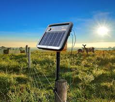
1. The Hardware: Personal Weather Stations (PWS)
The standard “city” weather report is often useless for a farm located 20 miles away. Elevation, tree lines, and local topography create microclimates that can vary significantly from the nearest airport’s readings. A Personal Weather Station (PWS) provides the “Ground Truth” for your specific acreage.
Core Components of an Agricultural PWS – The Meteorological Command Center
A professional-grade weather station is a modular suite of sensors, typically including:
Anemometer: Measures wind speed and direction. This is critical for determining “Spray Windows” to prevent chemical drift.
Hygrometer: Measures relative humidity. High humidity coupled with specific temperature windows is the primary trigger for fungal outbreaks.
Pyranometer: Measures solar radiation (Global Horizontal Irradiance). This data is essential for calculating Evapotranspiration (ET)—the rate at which water leaves the soil and the plant.
Rain Gauge: Modern “tipping bucket” or ultrasonic gauges measure not just the amount of rain, but the intensity, which helps predict soil erosion and nitrogen leaching.
Barometer: Measures atmospheric pressure to predict short-term changes in weather patterns (e.g., approaching cold fronts).
2. The Connectivity Layer: Getting Data from Field to Phone
In 2026, the challenge isn’t just collecting data; it’s transmitting it across vast, often remote, distances.
I. LoRaWAN (Long Range Wide Area Network)
LoRaWAN has become the industry standard for farm connectivity. It allows small, battery-powered sensors to transmit data over several miles using very little energy. A single gateway in the center of a farm can support hundreds of weather sensors for years on a single battery.
II. Satellite IoT
For ultra-remote operations where cellular service is non-existent, modern weather stations now utilize Low Earth Orbit (LEO) satellite constellations (like Starlink or Swarm). This ensures that a farmer in the most isolated corner of the highlands has the same real-time data access as an urban vertical farmer.
3. The Software Ecosystem: Beyond the Forecast
Data without analysis is just noise. Modern weather monitoring tools for farms rely on Decision Support Systems (DSS)—mobile and web applications that translate raw numbers into agricultural actions.
High-Resolution Modeling
While consumer apps use global models (like GFS or ECMWF), agricultural apps often utilize High-Resolution Rapid Refresh (HRRR) models. These provide 1km-resolution forecasts that can predict a localized thunderstorm down to the specific hour.
Hyper-Local Alerts
Farmers can set “Trigger Alerts” based on specific physiological thresholds of their crops.
Frost Alerts: If the temperature drops below $0^circtext{C}$ ($32^circtext{F}$), the system sends an automated call to start wind machines or irrigation heaters.
Pest Models: Many apps now integrate “Bio-Fix” dates, where the app combines weather data with pest life-cycle models to tell the farmer exactly when to scout for specific insects.

4. The Soil-Weather Nexus: Specialized Sensors
Weather doesn’t stop at the surface. The interaction between the atmosphere and the sub-surface is where the most critical biological decisions are made.
I. Soil Moisture and Temperature Probes
These are multi-level sensors buried in the root zone.
The Benefit: They prevent “Invisible Drought.” A plant may look healthy on the outside while its roots are struggling in dry subsoil.
The Logic: By comparing soil moisture to the pyranometer’s solar data, a farmer can calculate the exact “Leaching Fraction,” ensuring they don’t overwater and wash away expensive fertilizers.
II. Leaf Wetness Sensors
These sensors mimic the physical properties of a leaf. They measure how long moisture (from dew or light rain) stays on the foliage.
Fungal Defense: Most agricultural fungi (like Potato Late Blight) require a specific “Leaf Wetness Duration” to infect the plant. Knowing exactly how long leaves have been wet allows for “Reactive Spraying”—only applying fungicide when the weather conditions actually allowed the disease to take hold.
5. The Math of the Farm: Predictive Metrics
Modern weather tools use the data collected to calculate complex biological formulas. Two of the most important are GDD and ET.
Growing Degree Days (GDD)
GDD is a measure of heat accumulation used to predict plant development stages (e.g., when corn will silk or when wheat will reach maturity). The formula is:
Where $T_{base}$ is the temperature below which the plant does not grow (e.g., $10^circtext{C}$ for corn). By tracking GDD, a farmer can predict their harvest date with much higher accuracy than using “Days to Maturity” on a seed packet.
Evapotranspiration (ET)
ET tells the farmer how much water the field “lost” today. It combines solar radiation, wind speed, humidity, and temperature.
The Strategy: If the ET for the day was $5text{mm}$ and it didn’t rain, the farmer knows they need to put exactly $5text{mm}$ of water back into the field to maintain equilibrium.

6. Strategic Benefits of Weather Monitoring
| Benefit | How It Works | Economic Impact |
| Irrigation Efficiency | Pumping based on ET and soil moisture sensors. | 30% reduction in water and electricity costs. |
| Spray Optimization | Monitoring wind speed and leaf wetness. | Better chemical efficacy and reduced environmental runoff. |
| Harvest Planning | Using GDD and long-range forecasts to time the “Window.” | Prevents “Shatter Loss” from wind or rot from rain. |
| Risk Management | Historical data for insurance claims (hail/frost). | Faster payouts and more accurate premiums. |
7. Emerging Trends (2026): The Digital Twin
The “Next Gen” of weather monitoring is the Digital Twin. By combining real-time weather data with satellite imagery and AI, software can create a virtual 3D model of the farm.
This model can run “What-If” simulations. For example: “If we get 50mm of rain in the next 24 hours, which parts of the North 40 field will flood, and how much nitrogen will be lost?” This allows farmers to take preemptive action, such as applying stabilizers or clearing drainage ditches, before the weather event even begins.
8. Best Practices for Implementation
Placement is Everything: Do not place your weather station near buildings or under trees. An anemometer should ideally be 10 meters above the ground, while the rain gauge should be at a height where it won’t be splashed by ground mud.
Regular Calibration: Sensors drift over time. Rain gauges can get clogged with bird droppings or spider webs. A monthly physical inspection is the “Standard Operating Procedure” for reliable data.
Data Sovereignty: Ensure that the data your station collects belongs to you. Some “free” weather apps sell your hyper-local data to commodity traders. Choose platforms that prioritize farmer privacy.
Conclusion
In the modern agricultural landscape, weather is no longer an “Act of God” that must be passively endured. It is a data stream that can be harvested just like a crop. By deploying a PWS, utilizing LoRaWAN connectivity, and leveraging GDD and ET modeling, a farmer moves from a defensive posture to an offensive one.
Weather monitoring tools provide the clarity needed to make high-stakes decisions with confidence. Whether it’s saving a crop from a midnight frost or reducing a water bill by thousands of dollars, the “Met Command Center” is an essential pillar of the 21st-century farm. As climate volatility increases, the farmer with the best data is the farmer who thrives.
Are you ready to monitor your microclimate? Given the diverse array of sensors available, would you prioritize monitoring atmospheric conditions (wind and rain) for spray management, or sub-surface conditions (soil moisture and temp) for irrigation precision?